
DATA 041
Urban Vacant Land of 36 Major Chinese Cities
Beijing City Lab Data
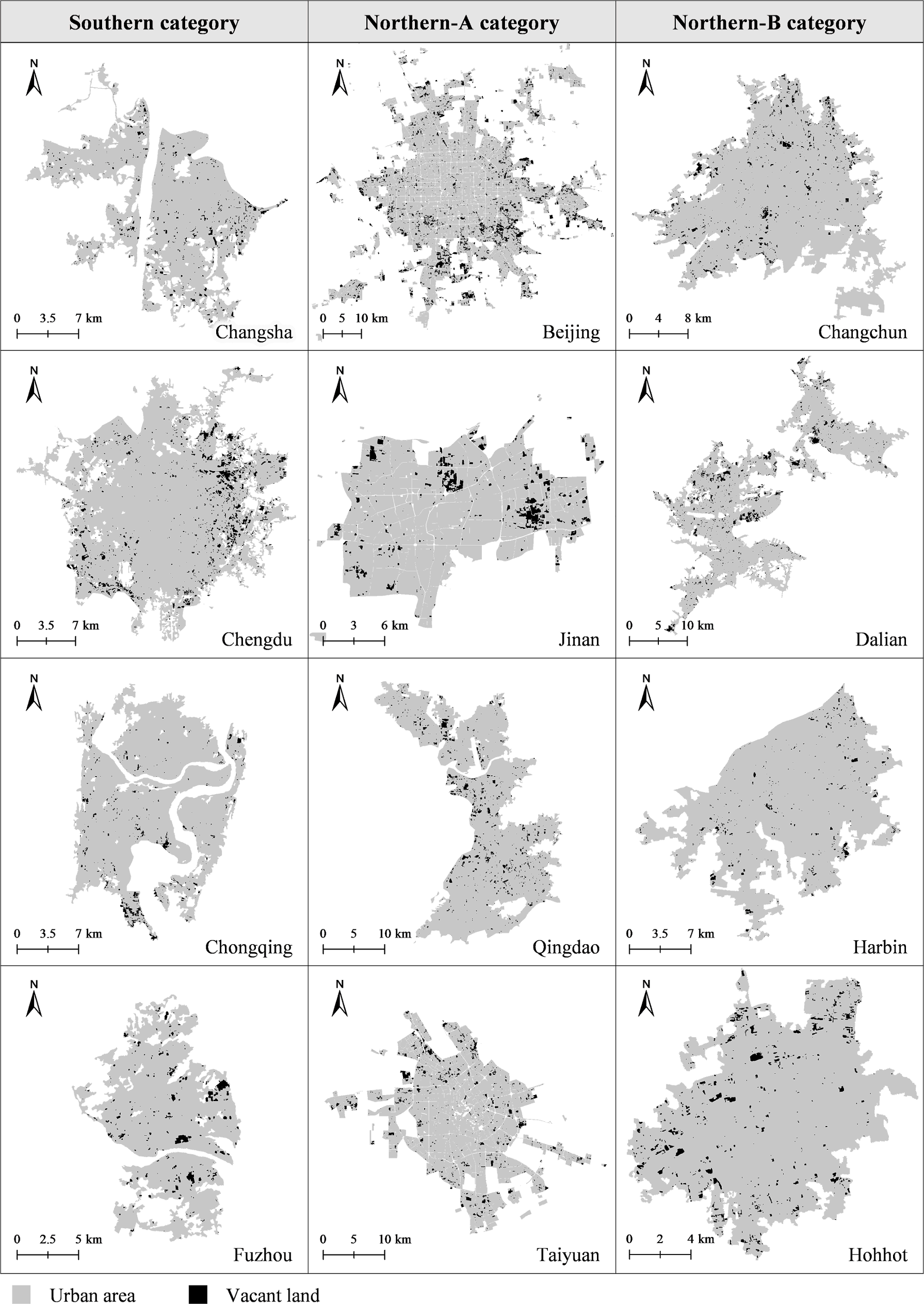
Type & Source The data include two parts: (1) urban vacant land of 36 major Chinese cities (in shapefile format), and (2) codes and data used for automatic vacant land identification. Urban vacant land is a growing issue worldwide. The study is aimed to realize large-scale automatic identification of urban vacant land. A framework based on deep learning techniques is proposed to extract urban vacant land of 36 major Chinese cities through semantic segmentation of high-resolution remote sensing images. The automatic identification framework is proved to be accurate and efficient, with strong robustness. This metho...
Media / 图片视频
Source Images / 原始图片
Text / 正文
Type & Source
The data include two parts: (1) urban vacant land of 36 major Chinese cities (in shapefile format), and (2) codes and data used for automatic vacant land identification.
Urban vacant land is a growing issue worldwide. The study is aimed to realize large-scale automatic identification of urban vacant land. A framework based on deep learning techniques is proposed to extract urban vacant land of 36 major Chinese cities through semantic segmentation of high-resolution remote sensing images. The automatic identification framework is proved to be accurate and efficient, with strong robustness. This method is expected to serve as a practical approach in various countries and regions. The data of urban vacant land of 36 cities can be used in further studies.
Citation
Mao, L., Zheng, Z., Meng, X., Zhou, Y., Zhao, P., Yang, Z., & Long, Y. (2022). Large-scale automatic identification of urban vacant land using semantic segmentation of high-resolution remote sensing images. Landscape and Urban Planning, 222, 104384. https://doi.org/10.1016/j.landurbplan.2022.104384.
Repository Access
Vacant-land shapefiles and city boundaries on Mendeley Data · DOI: 10.17632/3c8myvygjj.1 · Identification code on GitHub.
Downloads / 下载