
DATA 012
Beijing historical maps
Beijing City Lab Data
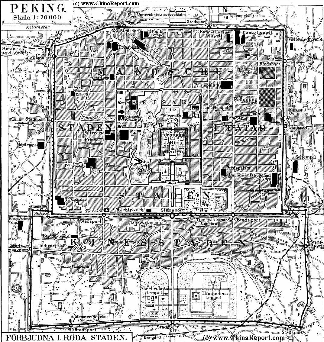
Type & Source Ten historical maps of Beijing digitised from the holdings of the U.S. Library of Congress. Each sheet was georeferenced to the contemporary Beijing OpenStreetMap basemap by BCL student member He Li on 17 Nov 2013. Spatial Coverage Beijing metropolitan area. Temporal Coverage Individual map publication years span 1861 – 1950. Format GeoTIFF files — spatially matched, ready for GIS analysis. JPEG files — original, un‑rectified scans. Typical Uses Historical urban morphology studies, comparison of city expansion over the late Qing, Republican and early PRC periods, map archival research, and cartograp...
Media / 图片视频
Source Images / 原始图片
Text / 正文
Type & Source
Ten historical maps of Beijing digitised from the holdings of the U.S. Library of Congress. Each sheet was georeferenced to the contemporary Beijing OpenStreetMap basemap by BCL student member He Li on 17 Nov 2013.
Spatial Coverage
Beijing metropolitan area.
Temporal Coverage
Individual map publication years span 1861 – 1950.
Format
- GeoTIFF files — spatially matched, ready for GIS analysis.
- JPEG files — original, un‑rectified scans.
Typical Uses
Historical urban morphology studies, comparison of city expansion over the late Qing, Republican and early PRC periods, map archival research, and cartographic heritage visualisation.
Citation
Library of Congress. (1861–1950). Historical maps of Beijing [map collection]. Digitised and georeferenced by He Li (2013), Beijing City Lab. https://doi.org/10.6084/m9.figshare.28667786.
Access & Documentation
Openly available via Figshare: https://doi.org/10.6084/m9.figshare.28667786.
Downloads / 下载
Files / 附件下载
File
No downloadable file listed / 暂无可下载附件