
DATA 028
Impervious Surface Areas Interpreted from DMSP‑OLS and MODIS
Beijing City Lab Data
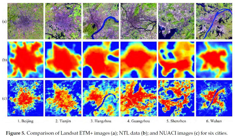
Type & Source Urban extent layers derived from DMSP/OLS and MODIS nighttime imagery, shared by Prof Xiaoping Liu (Sun Yat‑sen University). The dataset includes national‑scale urban area delineations for the years 2000, 2005, and 2010. Spatial Coverage Entire mainland China. Temporal Coverage Three time points: 2000, 2005, and 2010. Citation Liu, X., Hu, G., Ai, B., Li, X., & Shi, Q. (2015). A normalized urban areas composite index (NUACI) based on combination of DMSP-OLS and MODIS for mapping impervious surface area. Remote Sensing , 7, 17168–17189. https://doi.org/10.3390/rs71215863 .
Media / 图片视频
Source Images / 原始图片
Text / 正文
Type & Source
Urban extent layers derived from DMSP/OLS and MODIS nighttime imagery, shared by Prof Xiaoping Liu (Sun Yat‑sen University). The dataset includes national‑scale urban area delineations for the years 2000, 2005, and 2010.
Spatial Coverage
Entire mainland China.
Temporal Coverage
Three time points: 2000, 2005, and 2010.
Citation
Liu, X., Hu, G., Ai, B., Li, X., & Shi, Q. (2015). A normalized urban areas composite index (NUACI) based on combination of DMSP-OLS and MODIS for mapping impervious surface area. Remote Sensing, 7, 17168–17189. https://doi.org/10.3390/rs71215863.
Downloads / 下载