
DATA 050
Temporal evolution of urban physical disorder in China
Beijing City Lab Data
Type & Source These zip files contain data from the paper " Measuring Temporal Evolution of National-Wide Urban Physical Disorder: An Approach Combining Time-Series Street View Imagery with Deep Learning". The data comes from a large-scale analysis of urban physical disorder in 698 natural cities in China using street view imagery and deep learning models. Content & Format This folder contains the results of the multi-scale urban physical disorder measurement. Three shapefiles "point_result.shp", "subdistrict_result.shp" and "city_result.shp" record unique IDs and urban physical disorder levels for 2,643,959 samp...
Media / 图片视频
Source Images / 原始图片
Text / 正文
Type & Source
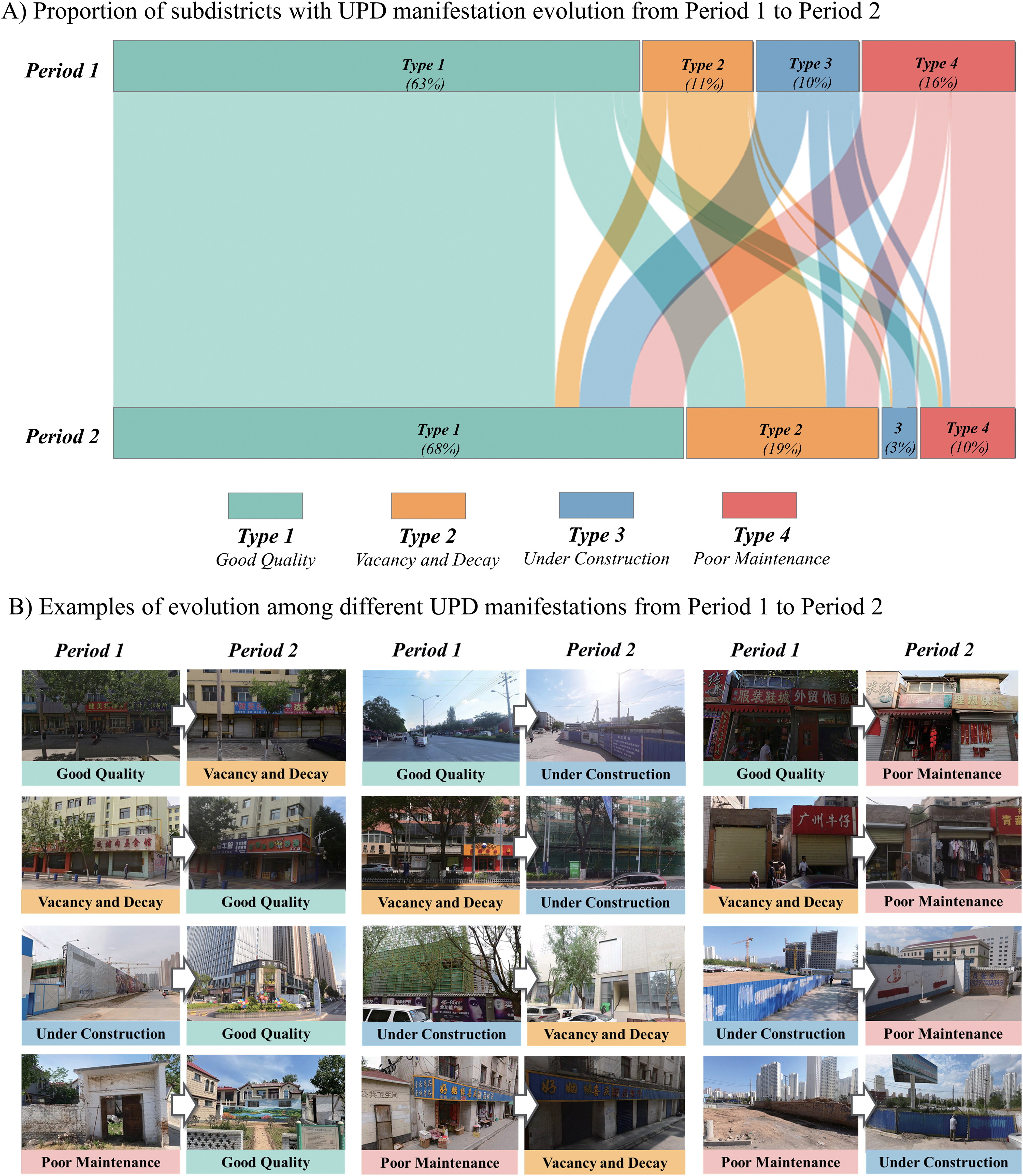
These zip files contain data from the paper " Measuring Temporal Evolution of National-Wide Urban Physical Disorder: An Approach Combining Time-Series Street View Imagery with Deep Learning". The data comes from a large-scale analysis of urban physical disorder in 698 natural cities in China using street view imagery and deep learning models.
Content & Format
This folder contains the results of the multi-scale urban physical disorder measurement. Three shapefiles "point_result.shp", "subdistrict_result.shp" and "city_result.shp" record unique IDs and urban physical disorder levels for 2,643,959 sampling points, 11,422 subdistricts, and 698 natural cities for two time periods, period1(UPD_P1) and period2(UPD_P2), respectively.
Citation
Ma, Y., Li, Y., & Long, Y. (2025). Measuring Temporal Evolution of Nationwide Urban Physical Disorder: An Approach Combining Time-Series Street View Imagery with Deep Learning. Annals of the American Association of Geographers, 1–26. https://doi.org/10.1080/24694452.2025.2467330
Access & Document
https://data.mendeley.com/datasets/b6b4sdxy95/1
Downloads / 下载
Files / 附件下载
File
No downloadable file listed / 暂无可下载附件