
DATA 031
High‑Resolution Multi‑Temporal Mapping of Global Urban Land
Beijing City Lab Data
Type & Source A groundbreaking multi‑temporal global impervious surface dataset derived from Landsat imagery spanning the years 1990 to 2010, in five‑year intervals. This product is the first global dataset of its kind offering 30‑meter resolution over a multi‑decadal timescale. Purpose Developed to address the limitations of existing global urban land products, which typically offer coarse spatial resolution (500–1000 m), inconsistent definitions, and limited temporal coverage. The dataset supports long‑term research into global urban expansion and its environmental impacts. Methodology Built on Google Earth Eng...
Media / 图片视频
Source Images / 原始图片
Text / 正文
Type & Source
A groundbreaking multi‑temporal global impervious surface dataset derived from Landsat imagery spanning the years 1990 to 2010, in five‑year intervals. This product is the first global dataset of its kind offering 30‑meter resolution over a multi‑decadal timescale.
Purpose
Developed to address the limitations of existing global urban land products, which typically offer coarse spatial resolution (500–1000 m), inconsistent definitions, and limited temporal coverage. The dataset supports long‑term research into global urban expansion and its environmental impacts.
Methodology
- Built on Google Earth Engine, leveraging its cloud-based processing power and complete Landsat archive.
- Uses an automated extraction approach based on the Normalized Urban Areas Composite Index (NUACI).
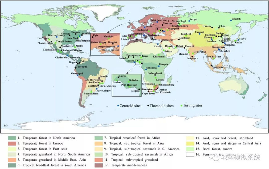
- Includes region-specific calibration based on the “urban ecoregions” stratification framework from prior literature.
- Demonstrated high accuracy across regions, with global Kappa values between 0.4280 and 0.4953, and comparable performance in country-level assessments (e.g., ~0.3306 for China, ~0.4163 for the U.S.).
Citation
Liu, X., Hu, G., Chen, Y., Li, X., Xu, X., Li, S., Pei, F., & Wang, S. (2018). High-resolution multi-temporal mapping of global urban land using Landsat images based on the Google Earth Engine Platform. Remote Sensing of Environment, 209, 227–239. https://doi.org/10.1016/j.rse.2018.02.055.
Access & Documentation
Downloads / 下载
Files / 附件下载
File
No downloadable file listed / 暂无可下载附件