
DATA 020
Urban Areas of China 2012 (by Various Methods)
Beijing City Lab Data
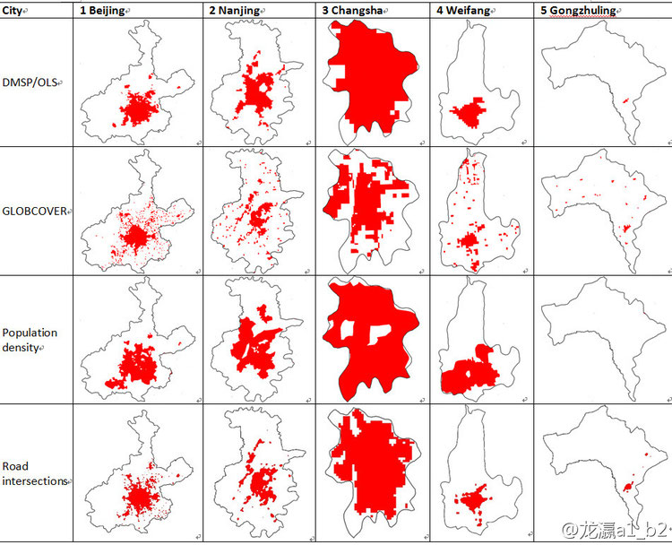
Type & Source A composite dataset produced by BCL that maps parcel‑level urban areas across China using four complementary approaches—benchmarking road‑junction density, population density, vector cellular automata, and GlobCover interpretation. Development details are described in Long & Shen (2014). Contents The download package contains four ESRI Shapefile layers: Road Junction Density Population Density (derived from BCL Data Population Density of China at the Town Level) Vector Cellular Automata GLOBCOVER‑based Urban Extent Citation Long, Y., & Shen, Y. (2014). Mapping parcel‑level urban areas for a large ge...
Media / 图片视频
Source Images / 原始图片
Text / 正文
Type & Source
A composite dataset produced by BCL that maps parcel‑level urban areas across China using four complementary approaches—benchmarking road‑junction density, population density, vector cellular automata, and GlobCover interpretation. Development details are described in Long & Shen (2014).
Contents
The download package contains four ESRI Shapefile layers:
- Road Junction Density
- Population Density (derived from BCL Data Population Density of China at the Town Level)
- Vector Cellular Automata
- GLOBCOVER‑based Urban Extent
Citation
Long, Y., & Shen, Y. (2014). Mapping parcel‑level urban areas for a large geographical area. arXiv:1403.5864. https://arxiv.org/abs/1403.5864 (later published in Annals of the AAG).
Downloads / 下载