
DATA 003
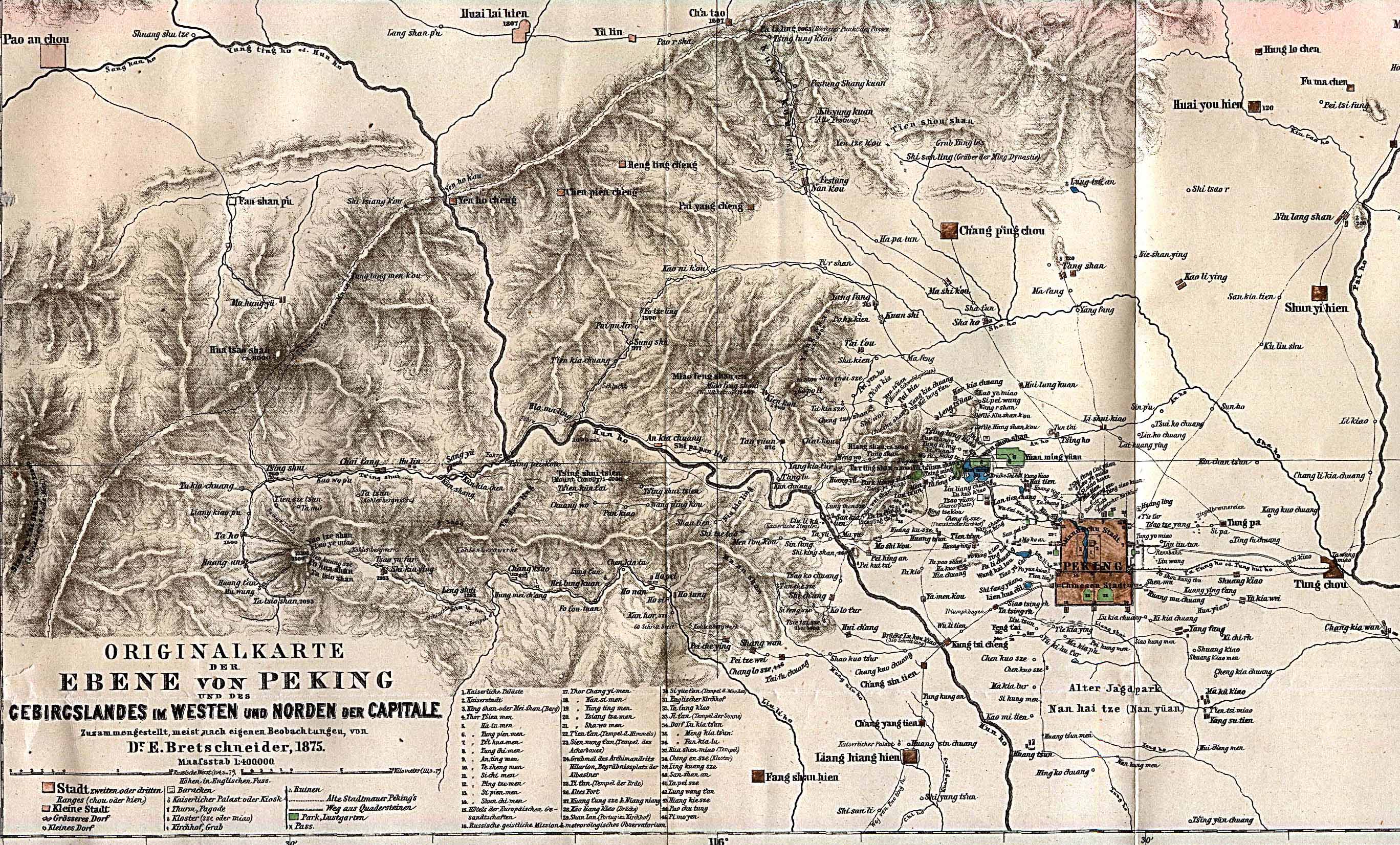
Beijing Map in 1875
Beijing City Lab Data
Type & Source A historical scanned map of Peking (Beijing) in 1875, published as part of CHGIS Version 2.0 by the Harvard Yenching Institute (2003). Project homepage: https://chgis.fas.harvard.edu/pages/intro/ . Format GeoTIFF: georectified for use in GIS platforms such as ArcView or ArcGIS (note: image is slightly skewed due to rectification). JPEG: original undistorted map image. Metadata: included in .XML and .HTM files (FGDC-compliant). Citation Harvard-Yenching Institute. (2003). China Historical GIS, Version 2.0: Peking (Beijing), 1875 [digital historical map]. CHGIS .
Media / 图片视频
Source Images / 原始图片
Text / 正文
Type & Source
A historical scanned map of Peking (Beijing) in 1875, published as part of CHGIS Version 2.0 by the Harvard Yenching Institute (2003). Project homepage: https://chgis.fas.harvard.edu/pages/intro/.
Format
- GeoTIFF: georectified for use in GIS platforms such as ArcView or ArcGIS (note: image is slightly skewed due to rectification).
- JPEG: original undistorted map image.
- Metadata: included in
.XMLand.HTMfiles (FGDC-compliant).
Citation
Harvard-Yenching Institute. (2003). China Historical GIS, Version 2.0: Peking (Beijing), 1875 [digital historical map]. CHGIS.
Downloads / 下载